Summer this year brought us to Colorado, and we spent a week exploring Ouray, nestled in the San Juan Mountains at 8000 feet in the southwest corner of the state. It was high enough that the air was cool and the mosquitoes nonexistent, two factors which make for a nice vacation in my opinion! Ouray also has a few hot springs spread around town, and it was cool enough in the evening to enjoy them.
There more than a few nice hikes in the area, as well as at least three of Colorado's fourteeners, mountains over 14,000 feet of elevation. Mt. Sneffels at 14,150 feet met that criteria. Even better, the approach to the mountain involved access via a jeep road to within a few miles of the summit.
The trail actually had two trailheads on opposing sides of the ridge, so we split the beautiful hike into two different days. The first day, we started at the lower trailhead at about 9,000 feet, with the dog, and made our way up to the Blue Lakes at about 11,000 feet. The trail was beautiful, the lakes were very blue and beautiful, and the wildflowers were at their peak. There were also some new avalanche paths due to the extremely high snow year. Aspen trunks were piled up like so many matchsticks at the bottom of the slides.
Spot enjoyed the trail, loved going for a swim, and actually made it almost 10 miles without laying down or otherwise complaining. That has to be a record.
 |
The lowest of the blue lakes was this amazing shade of teal.
No photoshopping needed! |
A couple days later, we drove up to the other trailhead in Yankee Boy Basin, allowing us to take the easy way up to over 11,000 feet. From there it was a couple of miles further up a rutted jeep trail to Blue Lakes pass, where we could look down on the trail we had taken before. Mt. Sneffels was still looking down on us, though.
 |
Mt. Sneffels, 14,150 ft. We ascended the left ridge, and descended the gully on the right
|
There are two ways up to the summit, neither one of them actually much of a trail. The slower but nicer way is up the NW ridge, where there is some rock scrambling involved, and some route finding. Faint trail marks in the dirt and some common sense helped us along without too much trouble there. Although we did pass a woman who was somewhat "frozen" with fear on a small class 3 scrambling section. It's mind over matter, really, and she was able to overcome her mind and continue on.

The view from the summit, as we desperately sucked in faint amounts of oxygen, was really amazing. Telluride was just over the next ridge, and the San Juan range was jagged and rocky, with just enough snow left to accentuate the peaks. We had the summit to ourselves for a minute, and then began picking our way back down the SE gully. The way down was very steep scree, and not much fun at all. It wasn't dangerous per se, just slow, as neither one of us wanted to take an embarrassing slide on our bums down the ball bearings that doubled as tiny gravel and rocks. We narrowly avoided such a fate, and found ourselves at the bottom more quickly that we had gotten to the top. The extra oxygen was a boon. We were back at the car with less than 8 miles round trip in about 4 1/2 hours.
 |
| My favorite trails meander through deep woods |
 |
| Spot loved swimming, the colder the better |
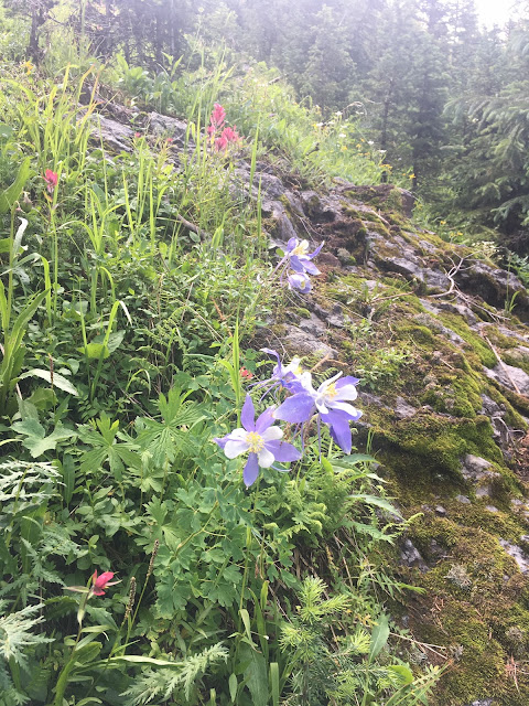 |
| The wildflowers were at their peak! |
 |
| Looking down on 2 of the 3 Blue Lakes from the Pass |
 |
| The beginning of the ridge scramble |
 |
| Plenty of snow left in mid August in Colorado after a record snowfall |
 |
| One of a million abandoned mines in Colorado |


No comments:
Post a Comment