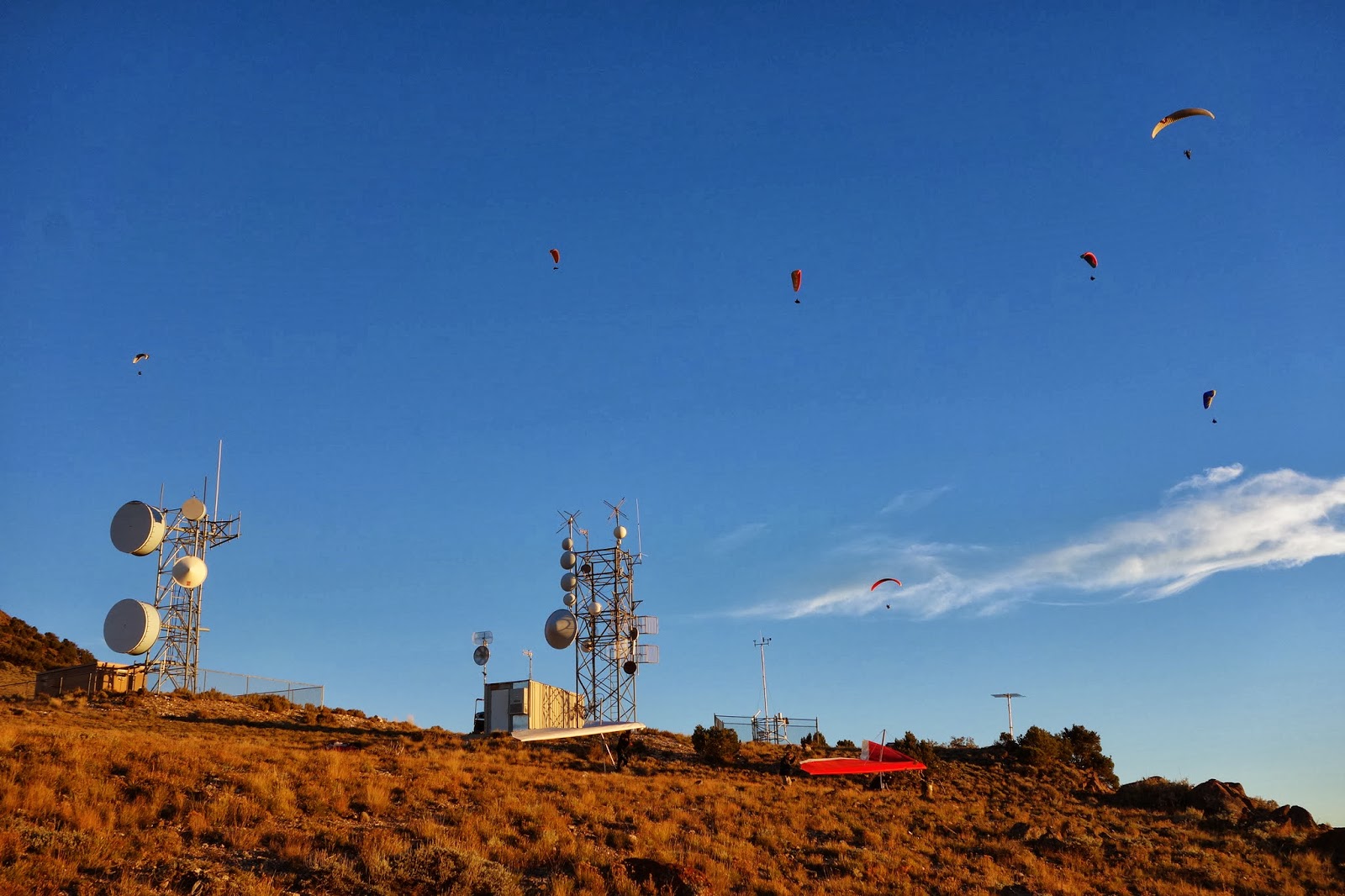
A great fall escape down to Richfield back in late September for the Red Rocks Fall Fly-In. Organized by Stacy Whitemore of www.cuasa.com, who pioneered a lot of the launch sites in Central Utah. We had some wonderful flying over the beautiful fall colors!
Dawn - Sometimes An Ultrarunner

Showing posts with label Paragliding. Show all posts
Showing posts with label Paragliding. Show all posts
December 5, 2013

October 22, 2013
Fly Camping in Central Utah
 So I enjoy camping, and I enjoy paragliding, and a very
small niche of people have started combining the two into a sport called Fly
Camping. Or “Vol Biv” in French, which
sounds a bit more exotic. In other
words, you carry everything you need to camp in your harness, and then after
you fly somewhere, you land on a mountaintop, camp for the night, and fly off
again the next day. Finding the right
weather for paragliding two or more days in a row is the key…getting stranded
on a mountaintop and having to walk down is kinda a buzzkill.
So I enjoy camping, and I enjoy paragliding, and a very
small niche of people have started combining the two into a sport called Fly
Camping. Or “Vol Biv” in French, which
sounds a bit more exotic. In other
words, you carry everything you need to camp in your harness, and then after
you fly somewhere, you land on a mountaintop, camp for the night, and fly off
again the next day. Finding the right
weather for paragliding two or more days in a row is the key…getting stranded
on a mountaintop and having to walk down is kinda a buzzkill.
I suppose this could be combined with Hike and Fly, which is where you hike up a mountain to launch your paraglider. But by adding all the gear for camping, your pack gets rather heavy so you may want to pick a smaller mountain to launch from than normal!
So I'm getting my gear together to do some Vol Biv, although it is rather late in the season and winter is approaching. But there are a few chances left this year, and I was just down at the Red Rocks Fly-In for an informal pilot get together. The weather was warm right when I arrived, so I took an opportunity to do some combined flying and camping right away. On the first afternoon of the Fly-In, we headed up to Cove Launch southeast of Richfield for an afternoon glass off. I had my brand new Advance Lightness Pod harness packed with all of my camping gear, namely tarp, sleeping bag, sleeping mat, food, stove and flashlight, among other small things. It was stuffed...but still almost lighter than other harnesses I've flown empty!
 The afternoon wind was strong and we launched quite late. I soared high above launch and decided that the best place to camp (and the safest for my first try) was launch itself, which had a large area where I could top land, and then perhaps fly with the group again in the morning if they came up for a morning sled ride. So although it wasn't very purist, I top-landed on Cove while there were still vehicles and a few pilots on launch. They finally left and I was alone on the mountain, under darkening starry skies and light winds. It was quite warm and the stars were brighter than anything I'd seen lately.
  My camping kit kept me quite warm for the night, although lacking a tent it did get a little chilly. So I pulled my wing over me and used the insulation from the fabric to add a few degrees of warmth. My camp was a little rocky under my thin sleeping mat...I had chosen it in the near dark and preferably I would search a little more in the future!
The next morning was clear and bright and a little windy, but it died off to nothing. I didn't want to wait all morning for the thermals to start up, so I just took a sled ride down to the landing zone where my car was waiting for me. Perfect! I'm heading to Iquique, Chile in a few weeks, and I'm gonna try it again there...at least down in the desert I don't have to worry about getting rained on!



September 17, 2013
Video - 2013 Open Distance Paragliding Nationals
Rob has outdone himself with the editing job this time!
More blogs and photos about the competition can be found at www.twocanfly.com
September 7, 2013
Inspo to the U of U...A New Paragliding Record (for Me!)
Well, you could say that the competition last week did not give me the flight I was looking for. Twice I was stopped just short of Lone Peak, which has been my goal all summer in the quest to land at the park in front of the house. So when the weather was looking good a few days later, I was hoping for that great flight of the summer. And I got it. Takeoff looked good early after I hiked up to launch from the valley. Luckily someone drove my gear up for me, it was hot enough hiking with no backpack!
Becky Brim launched early and was able to climb out from launch. She had been flying against me in the comp and we hadn't had a good day to fly together. So I launched, got up and we both caught a good thermal to take us high. No one else was around so I radio'd over to her that we should fly north. She agreed and we crossed Provo Canyon, getting pretty low and making a sweet save over the foothills on the other side.
I was flying a borrowed Nova Mentor 3, and was happy with the fact that I stayed ahead of Becky over the canyon. From there, she stayed put getting high in a thermal, while I pushed on to the north, wanting to get ahead of a developing cloud to the south. A few other people were climbing above launch by that point but no one else was with me so I just went. I figured if there was lift here there would be lift further on.
Sure enough, I was able to climb pretty steadily while flying north, eventually getting to American Fork canyon where twice the rain had put me on the ground during the comp. This time the peaks were looking sunny and clear, so I reached my maximum altitude of about 12,200 feet over Box Elder peak. I wasn't sure how fast the north wind was pushing in from the salt lake, so I made sure to climb up high on the side of Lone Peak. And soon, I was flying right over the peak! And I do mean right over...I cleared the spires by about 50 feet. And then found some really rowdy air. The valley north of the Point of the Mountain had a lot more wind, so there were different conditions to deal with. Pilots launching on the foothills below me were flying in the north winds from the lake, while up high at 10,000 feet it was still from the SW. I tried to stay above the mixing air, and looked at the house and park far below me.
Nah, I'm not going to go land there. I'm gonna keep heading north and see how far I can get. The hills and valley kept going, somehow I stayed pretty high, sometimes sailing along at 40 mph! The cloud behind me kept growing, putting the pilots flying behind me on the ground, but I stayed ahead of it, and saw I-80 passing far beneath my feet. I remembered that there was a TRAX station east of SLC at the University of Utah, so I decided to see if I could make it there. By the end it was a slow push into wind, but I was able to land in a grassy park just across the street from the TRAX station. That made it an easy cruise home on public transportation, a full circle of adventure which I always enjoy.
So I had the longest flight of the day in the area...that felt pretty cool. I flew about 55 km which I think is as far as I've ever gone. At least that I've measured. But wow...amazing high flight, such great views over the valley...I could see from the Oquirrh mountains all the way to Park City!
Some Cool Paragliding Links
I am posting my flights to XContest, a worldwide collection of flight logs. Here you can compare your airtime to others, and see maps of your flights, even join a contest!.
Dawn's XContest Flights
Track me LIVE in the air: David Wheeler has created a site to gather everyone's SPOT URLS so we can see where everyone is flying on a given day in our area.
XCFind
Want to know if it's going to be a good XC day for paragliding? XC Skies is a weather website run by Chris Galli, a successful XC pilot based in Utah. In depth weather charts of anywhere in the world. Customize your own page with favorite maps, routes and point forecasts. Subscription required, $4.95 a month. Try it free for a month. Well worth the cost for serious XC pilots.
XC Skies
Curious to see if you really did top out the lift on your highest climb of the day? Compare the tracklog of your flight to the predicted weather for the day along your route. Do this by uploading the .igc file of the your flight. Created by Chris Galli as part of XC Skies.
Weather/Flight Validation Uploader
See my flight on the weather validation tool. Notice that my flight showed I could have gotten much, much higher. This is rather misleading because along the Wasatch front, the Great Salt Lake tends to dampen the maximum height you can reach in lift, which isn't reflected in the weather forecast.
http://www.xcskies.com/cgi-bin/map/reviewlog.cgi?tid=1860#
For something a bit more interesting, check out the validation of Gavin McClurg's record 240 mile flight on Aug 6 from Idaho into Montana.
http://www.xcskies.com/cgi-bin/map/reviewlog.cgi?tid=1830
Want to fly somewhere new? This worldwide Paragliding Map gives you flying sites, local info, and weather combined into one site.
http://www.paraglidingmap.com
Becky Brim launched early and was able to climb out from launch. She had been flying against me in the comp and we hadn't had a good day to fly together. So I launched, got up and we both caught a good thermal to take us high. No one else was around so I radio'd over to her that we should fly north. She agreed and we crossed Provo Canyon, getting pretty low and making a sweet save over the foothills on the other side.
I was flying a borrowed Nova Mentor 3, and was happy with the fact that I stayed ahead of Becky over the canyon. From there, she stayed put getting high in a thermal, while I pushed on to the north, wanting to get ahead of a developing cloud to the south. A few other people were climbing above launch by that point but no one else was with me so I just went. I figured if there was lift here there would be lift further on.
Sure enough, I was able to climb pretty steadily while flying north, eventually getting to American Fork canyon where twice the rain had put me on the ground during the comp. This time the peaks were looking sunny and clear, so I reached my maximum altitude of about 12,200 feet over Box Elder peak. I wasn't sure how fast the north wind was pushing in from the salt lake, so I made sure to climb up high on the side of Lone Peak. And soon, I was flying right over the peak! And I do mean right over...I cleared the spires by about 50 feet. And then found some really rowdy air. The valley north of the Point of the Mountain had a lot more wind, so there were different conditions to deal with. Pilots launching on the foothills below me were flying in the north winds from the lake, while up high at 10,000 feet it was still from the SW. I tried to stay above the mixing air, and looked at the house and park far below me.
Nah, I'm not going to go land there. I'm gonna keep heading north and see how far I can get. The hills and valley kept going, somehow I stayed pretty high, sometimes sailing along at 40 mph! The cloud behind me kept growing, putting the pilots flying behind me on the ground, but I stayed ahead of it, and saw I-80 passing far beneath my feet. I remembered that there was a TRAX station east of SLC at the University of Utah, so I decided to see if I could make it there. By the end it was a slow push into wind, but I was able to land in a grassy park just across the street from the TRAX station. That made it an easy cruise home on public transportation, a full circle of adventure which I always enjoy.
So I had the longest flight of the day in the area...that felt pretty cool. I flew about 55 km which I think is as far as I've ever gone. At least that I've measured. But wow...amazing high flight, such great views over the valley...I could see from the Oquirrh mountains all the way to Park City!
Some Cool Paragliding Links
I am posting my flights to XContest, a worldwide collection of flight logs. Here you can compare your airtime to others, and see maps of your flights, even join a contest!.
Dawn's XContest Flights
Track me LIVE in the air: David Wheeler has created a site to gather everyone's SPOT URLS so we can see where everyone is flying on a given day in our area.
XCFind
Want to know if it's going to be a good XC day for paragliding? XC Skies is a weather website run by Chris Galli, a successful XC pilot based in Utah. In depth weather charts of anywhere in the world. Customize your own page with favorite maps, routes and point forecasts. Subscription required, $4.95 a month. Try it free for a month. Well worth the cost for serious XC pilots.
XC Skies
Curious to see if you really did top out the lift on your highest climb of the day? Compare the tracklog of your flight to the predicted weather for the day along your route. Do this by uploading the .igc file of the your flight. Created by Chris Galli as part of XC Skies.
Weather/Flight Validation Uploader
See my flight on the weather validation tool. Notice that my flight showed I could have gotten much, much higher. This is rather misleading because along the Wasatch front, the Great Salt Lake tends to dampen the maximum height you can reach in lift, which isn't reflected in the weather forecast.
http://www.xcskies.com/cgi-bin/map/reviewlog.cgi?tid=1860#
For something a bit more interesting, check out the validation of Gavin McClurg's record 240 mile flight on Aug 6 from Idaho into Montana.
http://www.xcskies.com/cgi-bin/map/reviewlog.cgi?tid=1830
Want to fly somewhere new? This worldwide Paragliding Map gives you flying sites, local info, and weather combined into one site.
http://www.paraglidingmap.com
September 1, 2013
Task 4: Rainshowers and a Short Day at the OD PG Nats
 It seems every day during this competition we've had better weather than we expected, making longer distances than anyone has thought possible. Today was the exception to that rule. There were clouds booming off all of the high peaks by noon when we arrived on launch, and they were quickly getting bigger. Rain was already coming at us over Utah Lake, so it was launch soon or not at all.
 Even getting in the air quickly didn't help much. There wasn't much lift organized at launch, and no one got high. I saw a couple of wings heading south, and decided to follow them. There was just enough lift to float along the ridge, I didn't bother trying to get very high because frankly the clouds above me were starting to look icky. At some point the sky clouded over completely as I soared above the Y. (Yes, it's a big white Y on the hillside). All lift seemed to die, the air got really still, I just kept flying south to get as much distance as I could before landing near a trail at the base of the hill.
 It was enough for 5th place on the day, although to be fair it was a short day and only counted for 1/2 the points of a longer day. I did win the women's division so the race is still on for second place between Becky Brim and I...Julie Spiegler is clearly in the lead for the win, and we can't catch her at this point.
 It started sprinkling within a few minutes of landing so everyone was quickly on the ground and back at HQ for an early finish. I think we're all pretty tired from long flights so a good sleep will see us ready to go for the last day of competition on Sunday.
 If any of you are wondering where my Orange and Blue wing is, I've left it in the shed this week and borrowed a faster wing from Ken Hudonjorgensen. My wing this week is a Sun Lava EN C, it's super fast and fun to fly. And it's got cool colors...yellow, red and blue in a design that looks like a phoenix. It's all about the colors, really!
See the live map of our spot trackers here http://xcfind.paraglide.us/comp.html?id=62
To check out other people's perspective on the competition, read Two-Can Fly's Blog HERE
Chris Galli, the XCSkies weather guru, blogs about weather HERE for the week.
Results are HERE


August 31, 2013
Task 3: Flying with the Big Boys at the OD Nats!
 Third time’s the charm.
Launch opened at 1230 for the 3rd task of the competition, and it seemed like going early might be
a good idea. Perhaps I thought that only
because I know I could get a ride up to relaunch if I sink out! But I was one of the first to launch, and I
didn’t sink out, but I scratched for a long time along with about 6 other wings
in the air. I didn’t recognize any of
them but eventually realized they weren’t in the comp. Instead, it was Nick Greece and his Vol Biv teammates, hoping to make a camping/flying trip up the Wasatch range just like
they had done previously in Nepal and California. Vol means flying in French, so Vol Biv means something like fly camping. I
think I’m going to try something like that next summer…I’ll call it sky
camping.
Third time’s the charm.
Launch opened at 1230 for the 3rd task of the competition, and it seemed like going early might be
a good idea. Perhaps I thought that only
because I know I could get a ride up to relaunch if I sink out! But I was one of the first to launch, and I
didn’t sink out, but I scratched for a long time along with about 6 other wings
in the air. I didn’t recognize any of
them but eventually realized they weren’t in the comp. Instead, it was Nick Greece and his Vol Biv teammates, hoping to make a camping/flying trip up the Wasatch range just like
they had done previously in Nepal and California. Vol means flying in French, so Vol Biv means something like fly camping. I
think I’m going to try something like that next summer…I’ll call it sky
camping. 
At any rate, when a good thermal came along, it was just me and the sky gods who were in it together, taking it all the way up to the top of Cascade Mountain. Rain was coming across Utah Lake, and down on launch the rain shadow prevented anyone else from launching. I learned later that they were all stuck on the ground until almost 4 pm (when most then went on to get stellar flights to the south).
But up on Cascade, all I knew was that I was thermaling with
pilots who were way above my pay grade, and somehow almost keeping up with
them. I wasn’t sure which direction they
were headed, so I left to fly north to Mt. Timpanogos. When I looked behind me, the Vol Biv group was following me, albeit somewhat higher. That's ok, I made it to the Timpanogos ridge with plenty of height, and surfed along the side of the mountain. I didn't bother getting high because I was going for distance, not height. I did scare some animals crossing some scree slopes (were they elk?) and the Vol Biv guys kept pace with me above the ridgetop.
On the north end of the ridge is a large valley. American Fork canyon is nothing to sneeze at, and I wasn't sure if it was safe to cross it from there. So I went out front to Mahogany to cross a narrower spot, which took a lot longer than a straight crossing. The Vol Biv guys evidently knew what they were doing, crossing it the shorter way, and the next time I saw them they were disappearing over Lone Peak. I eventually made it over the canyon, but by then a rainstorm over the valley was brewing up and coming my way fast. The sunshine over Lone Peak disappeared within 5 minutes and I knew I was just a few minutes to late to get over that mountain and into blue sky again.
 In fact, the rain and clouds were moving faster my way now, and I was kinda boxed into the mountains above Alpine. All I could do was make a few climbing turns to get over Box Elder Peak, and then dash down the other side to avoid the potential life-threatening storm coming my way. There was no lift on the other side, and some sinky air, so within a few minutes I was landing at Silver Lake, and quite happy to be safe on the ground. I even managed to find a ride down the bumpy gravel road to avoid having someone drive up to get me...so it was a great day of flying.
If the day had ended then, I would have had one of the best flights of the day! But everyone else managed to relaunch after I had landed and had some great flights to the south. I'm still looking for that big day when I can fly north all the way to Salt Lake City...perhaps I'll land downtown somewhere :)
Thanks Terri Olsen and Jim Petersen for the photos!
To check out other people's perspective on the competition, read Two-Can Fly's Blog HERE
And Chris Galli, the weather guru, blogs about weather HERE for the week.
Results are HERE
Thanks Terri Olsen and Jim Petersen for the photos!
To check out other people's perspective on the competition, read Two-Can Fly's Blog HERE
And Chris Galli, the weather guru, blogs about weather HERE for the week.
Results are HERE


 |
| Nick Greece flying with the Utah Vol Biv Expedition |

 |
| Rain headed our way over Utah Lake |
August 30, 2013
Task 2: 2013 OD Paragliding Nationals
 We started out the day with the awards ceremony for the first task. Andrew Dahl won the day by flying to Bountiful, Utah, amazing considering he lives in Minnesota and hasn't flown much in mountains at all. I won a bag of dirt, the award for "dirting" the most times, with 3 launches all sending me straight down into the LZ! I'll try not to repeat that award!
The weather continues to improve for the week, and our second task was looking to be a good one. Thunderclouds were forming earlier than usual so we were all looking to launch earlier than normal to get some distance before the day turned to rain. Although the weather briefing by Chris Galli mentioned that the day might be drying up later...that should have been a clue.

I hiked up to the upper launch at Inspo to give myself that extra couple hundred feet of elevation to start with. I was back to my old harness and helmet, so comfortable again with my equipment and hoping that the speedier wing would help me out.
I did launch pretty early but waited until I saw at least someone else staying up. I was able to stay flying for a few turns but eventually sunk down to the lower launch, where I top landed. But it was still looking good, so a quick relaunch was called for. This time several of us were around to mark thermals and I got high enough where I said, "it's time to cross Provo canyon to the north".
 I made it across the canyon. Barely. A thermal thumped me up just as I was picked out a landing spot. Then I scratched and scratched, gradually getting higher on the low slopes of Mt. Timpanogos. It started to get fun then, as the southern wind was just pushing me up the ridges.
 I finally climbed up to about 8,000 feet coming across American Fork canyon when voices on the radio started worrying about rain out in the valley. I wasn't sure how much danger I was in from wind gusts, but I saw 3 wings on the ground below me and no one was flying. In retrospect, I should have thought about this a little longer, but I just made a snap decision to spiral down and join the other pilots on the ground. I literally spiraled down 4,000 feet to land in the soccer field next to Becky, Cliff, and David.
 Anyway, the rain left soon after and more pilots flew over our heads and proceeded to fly all the way to Farmington, Utah; down south to Nephi, Utah; and northeast to Ft. Bridger, WY. It was an amazing day to be in the competition...the furthest distance was flow by Chris Galli at 155 kilometers!
To watch us fly LIVE during the rest of the comp, see the map of our spot trackers here http://xcfind.paraglide.us/comp.html?id=62
To check out other people's perspective on the competition, read Two-Can Fly's Blog HERE
And Chris Galli, the weather guru, blogs about weather HERE for the week.
Results are HERE

 |
| Rob putting out lunch for the competition |
 |
| My bag of dirt for "dirting" the most times of the day! |

August 29, 2013
2013 Open Distance Paragliding Nationals Competition: Aug 24- Sep 1, 2013
 So I am flying in, and volunteering with, the Open Distance Paragliding Nationals organized by Ken Hudonjorgensen of Two-Can Fly Paragliding. The competition is run out of central Utah, and the main launching area is Inspiration Point, also known as Squaw Peak Lookout above Provo. The "Open Distance" part of the competition means that pilots are tasked to go as far as they can in any direction from launch. The furthest track in a straight line from launch wins the day.
 Our first day of flying was actually our 4 day of the competition, due to Tropical Storm Ivo remnants saturating the air and keeping us out of the sky. Even this day looked a bit iffy, but we went up to launch anyway and it turned out to be a cracking day for some pilots. By late afternoon retrieve drivers were sent out north, south, and east of launch, picking up pilots landing in Bountiful, Park City, and Salem, Utah!
 Me...not so much. I was trying out a new wing, harness and helmet (I know, I know...never try something new in a competition!), and I couldn't get my flying to come together. I think I had the record for the most relaunches, making 3 flights from Inspo. I landed twice at the main Landing Zone (LZ), but then was short the last flight and did a sidehill landing on dry tall grass. At least my GoPro video of it looks cool!
 Hoping for better things tomorrow and back to flying my old harness....less to think about in the air to focus on the thermals.
To check out other people's perspective on the competition, read Two-Can Fly's Blog HERE
And Chris Galli, the weather guru, blogs about weather HERE for the week.


July 11, 2013
Red Bull X-Alps 2013
The most amazing competition in the paragliding world is happening right now. 31 athletes are racing 1000 kilometers across the Alps from Austria to Monaco. If they can't fly, they hike. When they get too tired to hike, they keep hiking...or hope to get a break and launch again! Everyone hopes to be the first one to land off the coast of Monaco, in 16 days or less.
The race only takes place every two years, and this is the sixth edition. It seems to just keep getting longer, and harder. although there are mandatory rest periods at night so at least the tired athletes get to sleep!
Follow the competition here. Every athlete carries a live tracking device so you can see them flying in real time. Watch out, you may get addicted! http://www.redbullxalps.com/live-tracking.html
And for the record, someday I want to participate in the X-Alps. I love the idea of such a challenge. Is this a pipe dream? Maybe...but look for my entry in a couple of years.... :)

The race only takes place every two years, and this is the sixth edition. It seems to just keep getting longer, and harder. although there are mandatory rest periods at night so at least the tired athletes get to sleep!
Follow the competition here. Every athlete carries a live tracking device so you can see them flying in real time. Watch out, you may get addicted! http://www.redbullxalps.com/live-tracking.html
And for the record, someday I want to participate in the X-Alps. I love the idea of such a challenge. Is this a pipe dream? Maybe...but look for my entry in a couple of years.... :)

July 6, 2013
Rat Race Paragliding Competition: Task #3
 Whew. It's hot. A third task for the Rat Race, and our last day of competition was a scorcher. The shade tent at launch was a popular place, until it was time to take our group picture. Flying suits were left on the ground today, and even light layers were warm enough for climbing into higher altitudes in the high temperatures.
Our third task seemed tough. Up and over the hills to the south, then back to launch and over to a landing at Longsword Winery. Everyone wanted to land there because a free glass of wine always sounds enticing after a nice flight!
The Race group took off first as usual for their longer task. They formed a beautiful gaggle in a thermal overhead, circling like vultures over a particularly tasty morsel. When the start gate opened for them, they streamed out in a line on their way to a stellar flight.
 The Sprint group window opened just then, and I got busy setting up my equipment. I was borrowing another vario from the Flymaster dealer, so my flight deck actually looked really professional with all the electronics strewn across it. Conditions were a little light as we started off, but we all managed to get high in time for the start gate. This time a big group of us took off together, and I was in good company as they streamed out ahead of me. And then they showed me where the thermals were. Yay.
  The advice from the pros in this sport is always simple. Get high, then stay high. For the first time, today I was actually able to do that, soaring in strong thermals up to almost 8,000 feet, where the trees below me started to look smaller and less scary. Over the highest peak, I was able to climb to my highest elevation of the day, which made the furthest turnpoint seem really easy to reach. Wings were circling below me but I made it over the valley easily and back to the hills. Ok, so I was getting lower by that time, but instead of desperately circling in the weak lift, I sort of surfed the ridgeline back up to the higher spots. Then a booming thermal took me back up to where the clouds would have been if there had been any in the blue sky. One other pilot in a blue wing was circling up with me, with him hooting and hollering in the strong lift taking us higher and higher.
  From there, it was easy to get back to launch. One more thermal up, and I had the LZ on glide. No, I didn't really care about my speed, so I did a few extra circles in lift anyway, and came over the finish circle with thousands of feet of extra elevation. YAY, I FINALLY MADE GOAL!!!!!
Since I had height to play with, it gave me time to go fly around a little more without any stress. Then I celebrated with about 40 deep spiral turns, which is the best part of paragliding (for me, anyway). Landing at the winery was a busy place, with wings balled up all over the place and the hot sun beating down. Everyone was ecstatic that they had made goal, many of them like me, for the first time ever in a competition.

The final awards ceremony was that evening. I was happy to come third again for the day in the women's category. Even more awesome, I came in second overall in the Sprint Women's category! (For those of you who are slightly confused by how I placed higher in the overall than I ever did on a single day, there is only one word for it: consistency. A few of the women who beat me must have done really well on one day, and then not so well the other days.) Although the woman in first place, Julie Spiegler, made goal and came first every day, beating me by a country mile. The prizes were some really beautiful glass vases, very cool!

The last days results and the overall RESULTS ARE HERE.


 |
| Landing at the Winery |
June 29, 2013
Rat Race Paragliding Competition: Task 2
 Another great day of sunshine and it's time for the second task of the 2013 Rat Race Paragliding competition. Some pilots just wanted to continue their great flying. Some of them, like me, wanted to realize the elusive goal for the first time ever. We arrived on the hill early and it was already scorching. Temperatures in the valley were supposed to reach 100 degrees. Even high in the air, it wasn't going to be cold. I packed up my winter flying suit and flew in a light windshirt. Which left me lacking pockets to put things in, like food and drinks. (Later in the air, my water bottle threatened to fall out during some rough thermals. Finding nowhere to put it while wrestling the punchy air, I finally just stuffed it down my shirt. I didn't have time to drink it anyway.)
  The task committee lined up another challenging task for the Sprint group. Only a few kilometers shorter than yesterday, it took us up and over the high ground several times. On the map, it looked possible. In reality...nothing is ever certain. There are so many unknowns in paragliding. On our fragile cloth wings, we are at the mercy of air currents, invisible to us aside from guessing and hoping where there might be lift. We pretend to have educated guesses but even those can change depending on the day, the location, the weather, and our state of mind.
  My wing is slow. I'm low on the weight range, so I climb easily and then get passed by every other wing out there. Or at least that's what it feels like. So I like to get out as early as I can...I figure then I have all day to let people pass me, and then show me where the lift is ahead of me. On the other hand, if I would start later, I would just get further behind, and then there would be no one in sight the whole race.
  The race group launched ahead of us, and formed a perfectly beautiful gaggle of wings out in front of launch. Then it was our window...I was ready when it opened and got in the air. And somehow, impossibly, found myself high again, looking down over dozens of circling wings. And they stayed that way, too, as the start time crept up. When the first time to race opened, there were only 5 of us high, with everyone else struggling far below. I couldn't help myself. I went.
  The first turn point was close. The turn points are circles laid over the map, of varying sizes. In today's task we had 10 circles to fly "into", ranging from a 400 meter circle to a 4 kilometer circle. These circle are, of course, invisible to the naked eye...only the GPS on my flight deck knew where they were. When I reached the edge of one, all that is required in this race, my electronics would beep happily to let me know that it was time to turn for the next one. In fact there was a lot of beeping going on today...I had borrowed a new GPS/Vario, and the new style of beeps let me know when I was climbing, when there was no lift at all, and too often, when I was sinking (and how badly!).
  So we were off, and at the first circle from the start. All 5 of us, which considering there were almost 200 wings flying around, wasn't very many. I was high. I kept going and crossed my fingers we would make the valley crossing. We did, we found lift, and I kept breaking the rule all day of "never fly alone". I couldn't help it, no one seemed to be going my way when I was high. But luckily, there always seemed to be someone around around when I was getting low.
It was very bumpy. The lift was really strong in places, and entering a thermal sometimes felt like a giant fist had suddenly grabbed my wing and yanked it straight up. The radio chattered with warnings about higher winds in the valley, and someone landed in a tree (again) after throwing their reserve chute. I determined that I needed to get high and stay high.
 People seemed to be sinking out all around me, but somehow I made it back across the tree covered hills to launch. Low. I circled just a few hundred feet over launch, verbally yelling at the wind. "Come on, this is launch! Give me a thermal, already!" As I was scratching with a few other people, finally I got good lift and several thousand feet over launch. Cool air was welcome again. It was hot.
Another turnpoint north in the valley. I took a bad line but still got there, and then I was back over the trees again. No one around, no lift, and basically I got cold feet. I looked behind me, saw that there was lift over the valley above me, and went back. Mistake. In minutes I was below launch, looking down at the main LZ (landing zone) below me, thinking that I had a good day but all good days must end.

I wore my Go Pro today on my helmet so got some good pics! Plus Rob has been roaming the takeoff for great shots of the gaggles in the air.
My finish today was enough to net me 3rd place in the women's race. Very cool! Women's Results and overall results here. I am third overall now as well, but it's really close. Tomorrow's task will likely shake up the places again.


Subscribe to:
Posts (Atom)